
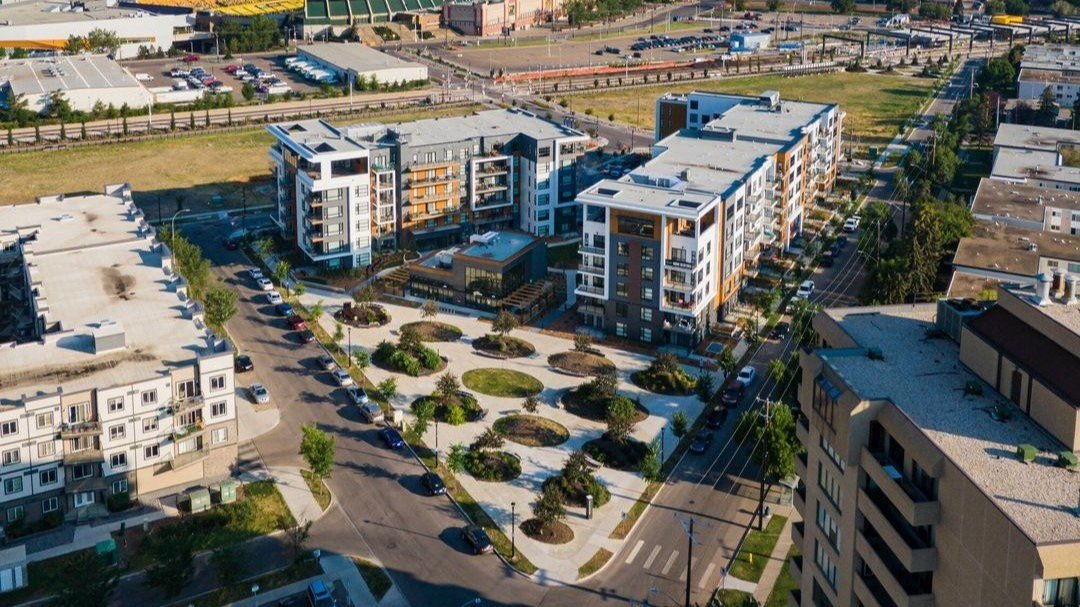
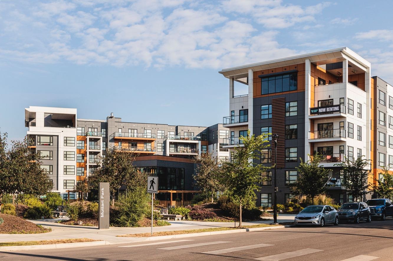
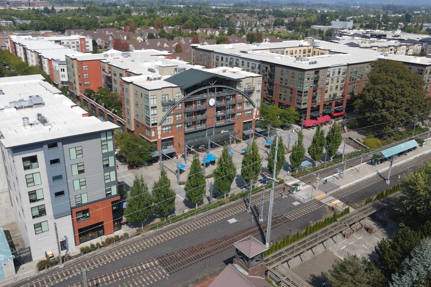
DENVER ALAMEDA STATION TOD
Fundamentals
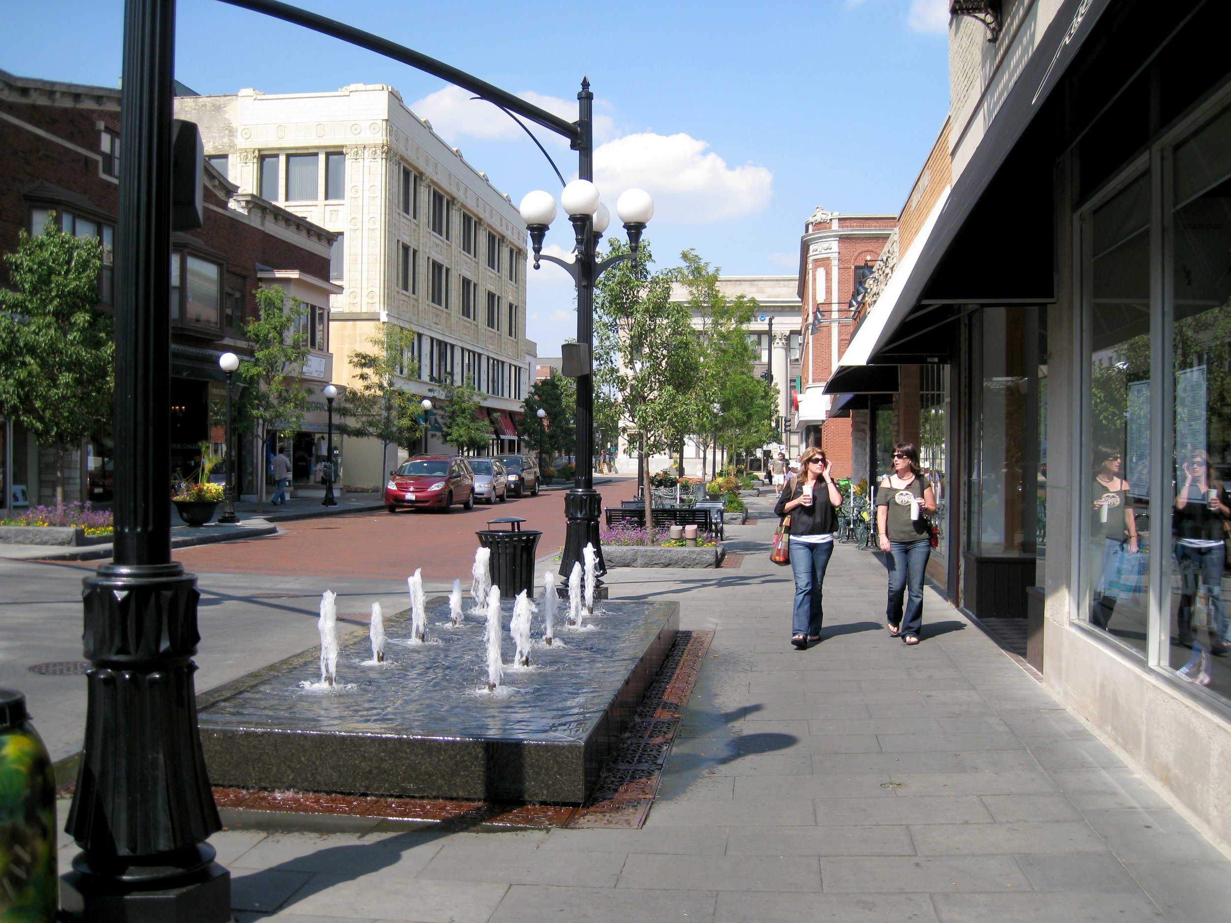
A transit stop alone will not spur mixed-use station area development.
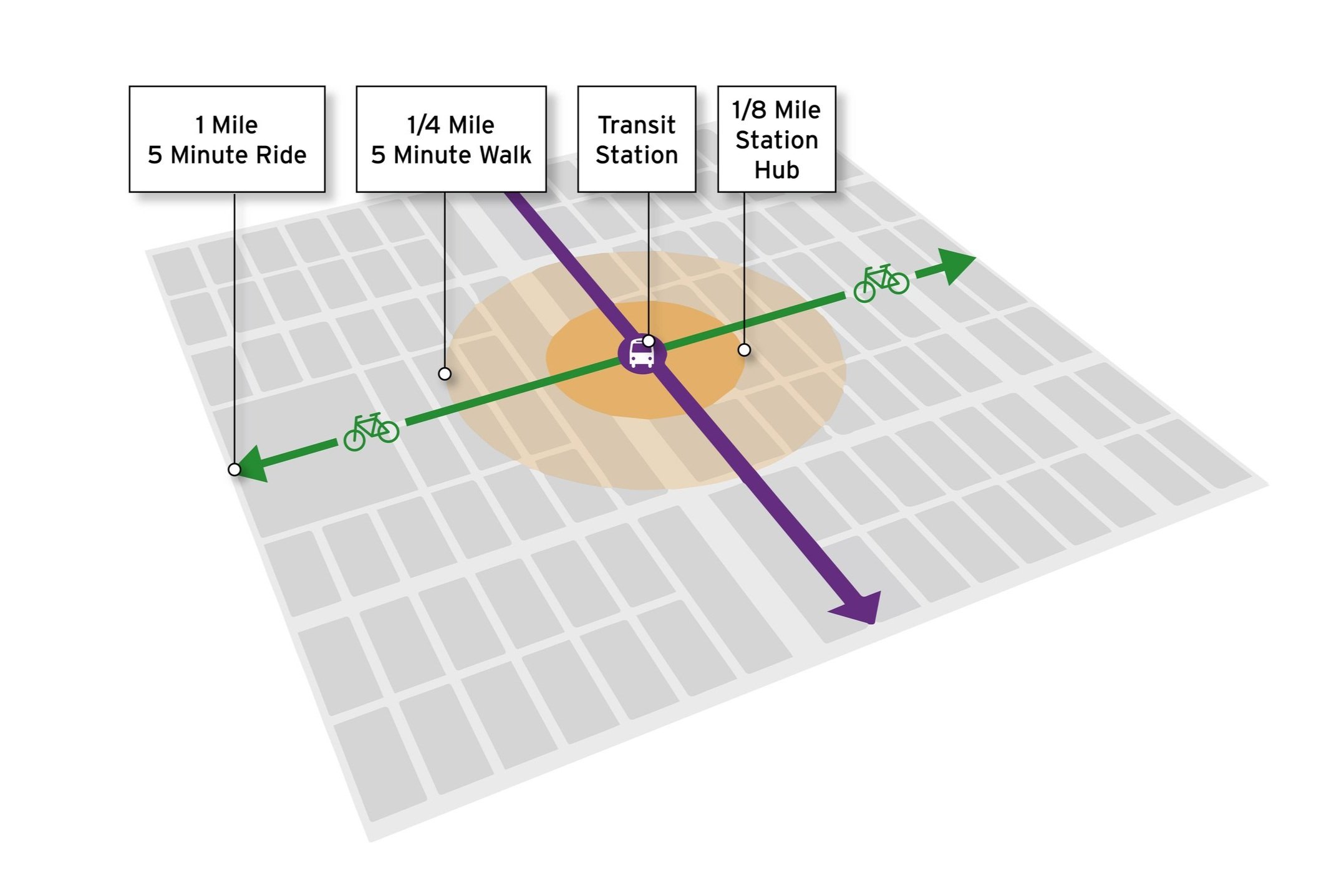
TOD (Transit-Oriented Development)requires complete neighborhoods in which land uses are located according to market fundaments and are integrated with pedestrian, bicycle, auto, and transit networks. In a TOD, housing, shopping, and employment are concentrated within ¼ mile of the transit station along a network of walkable and bikable streets.
“Crandall Arambula is recognized for having national expertise in TOD. We have been exceedingly pleased with Crandall Arambula.”
Loretta Daniel
Principal Planner
City of Aurora, Colorado

Ideal TOD
Crandall Arambula continues to explore methods for improving economic vitality and quality of life around transit stations. As experts in transit-oriented development who have designed and planned over one hundred station area plans across North America, we understand the factors critical in creating vibrant and economically viable communities with high transit ridership.
Crandall Arambula designs and plans TODs as 'one-stop destinations' consisting of a ‘hub’ of concentrated retail, commercial, and employment uses accessible on foot from the neighborhoods within 1/4 mile of the station. Focusing trip-generating retail and commercial uses at the hub of a community allows surrounding residents to shorten or eliminate auto-based trips. It provides a platform for local entrepreneurship, small business development, and employment close to home.
Fundamental TOD requirements include:
Great Retail — Continuous, street-oriented retail with curbside parking
Great Housing — A variety of high-density housing types for a range of income levels
Great Employment — Medium to large parcels with a good front door address
Complete Streets — Safe and convenient circulation for pedestrians, bicyclists, autos, and transit
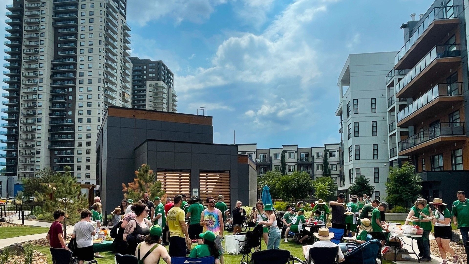
Great Parks — Spaces designed as an essential amenity for housing and retail
Equitable TOD
No station area is in stasis. A city’s neighborhoods around transit either improve or decline. New TOD investment in communities should be promoted in conjunction with policy, plans, and anti-displacement strategies that ensure that the benefits of TOD—improved livability, access to services, retail, and jobs, and increased property values are shared with community members who may be at risk. In the absence of these plans and strategies, revitalization causes sharp increases in rents and home values in low and moderate-income neighborhoods resulting in the displacement of residents.
Crandall Arambula’s research shows that building premium transit services, like streetcar and light rail, increases rents and home prices in the proximity of the stations. While some people benefit from the change, increased housing costs may lead to the displacement of many residents below the poverty level who benefit from improved transit service. This neighborhood change also has the long-term potential to reduce transit ridership as new higher-income households typically opt out of the transit system. To combat this, Crandall Arambula identifies and provides policies and programs that ensure existing at-risk residents and businesses benefit from transit as the core component of our TOD planning efforts.
TOD Potential

Tod Academy - Edmonton Alberta
TOD potential is often overlooked when agencies plan transit networks.
High levels of transit ridership depend on the development of supportive land use and circulation around the station. The potential for supportive development can be maximized or precluded by the route of the transit line and the locations of stations.
Not all line options and station locations are equal and each may accomplish a different objective, such as lower construction cost or
greater TOD potential. To maximize the public’s return on transit investment and increase transit ridership, TOD potential should be a primary consideration in all stages of transit system planning.
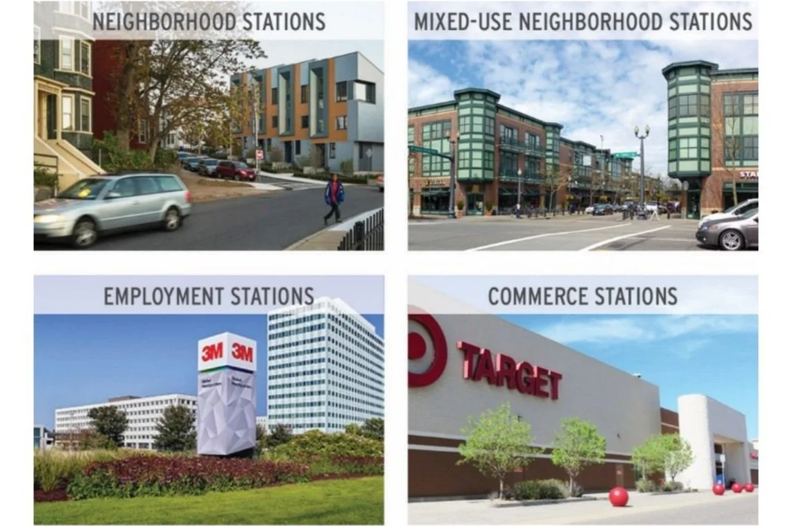
TOD Station Typologies
Crandall Arambula avoids a one-size-fits-all approach to TOD as well. We create station areas that address unique site, physical, social, and economic conditions. As a result, we create TODs that contribute positively to a viable and livable transit corridor. Within each station area, we analyze, plan, and design based on existing and potential:
Transit Platform Environment
Pedestrian and Bicycle Access
Residential Uses
Employment Uses
Retail Uses, and
Transitions to existing development
“Our work has taken the Integrated Transit and Land Use Framework to the next level and will be a great benefit to both the planning and transportation departments.”
Mary Ann McConnell-BoehmDirector, Planning Initiatives City of Edmonton, Alberta
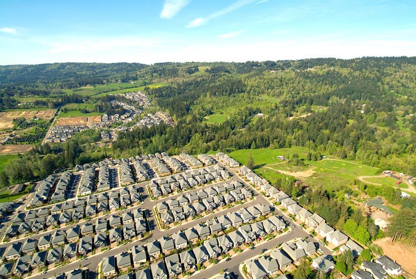
Infill TOD
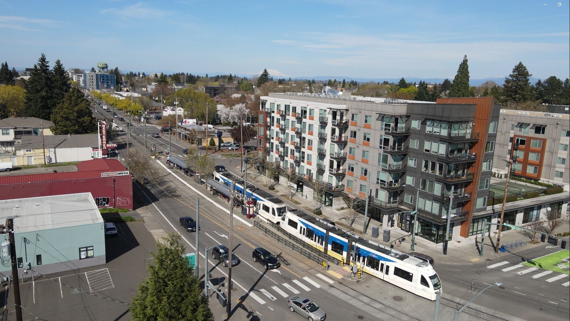
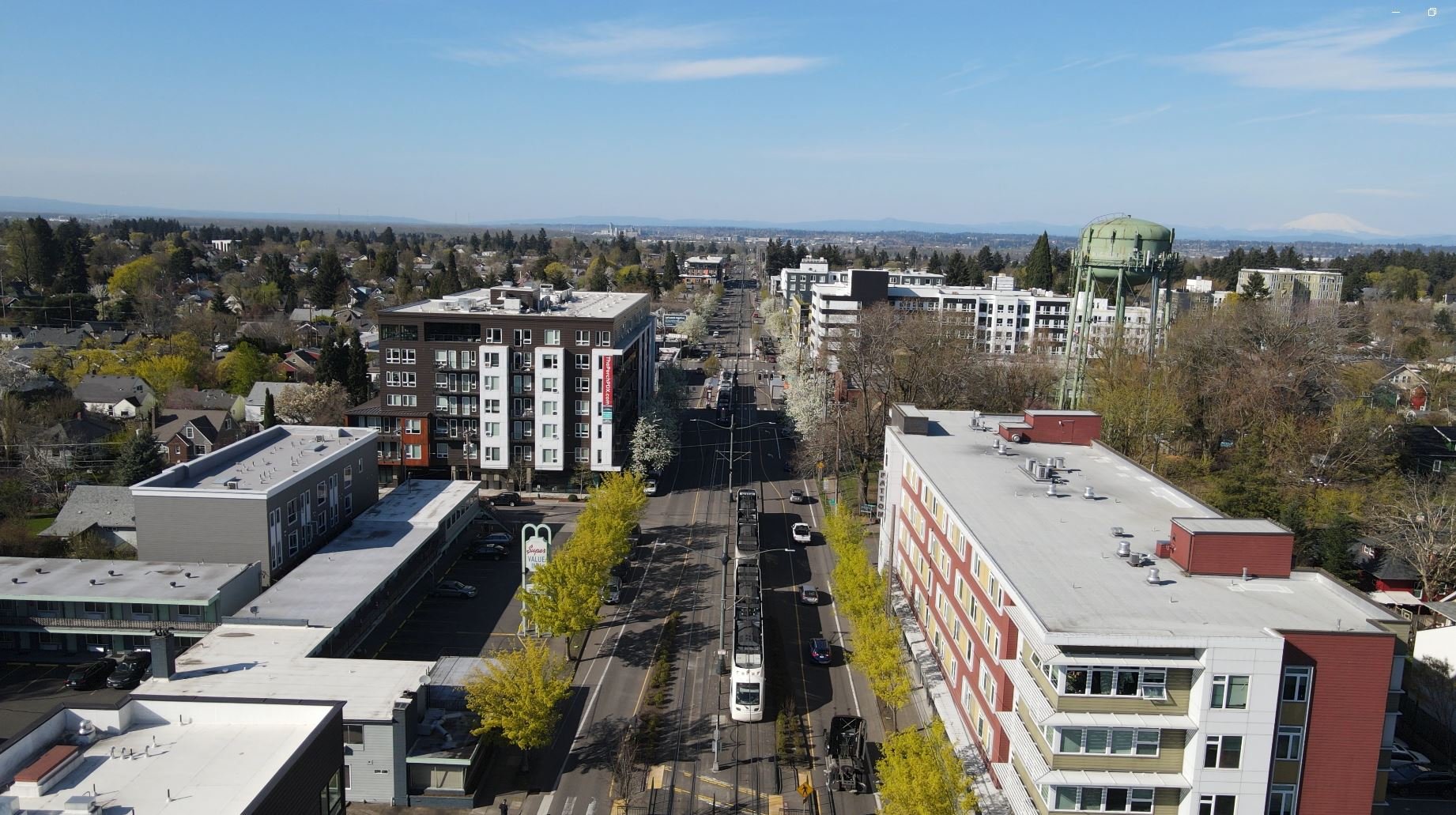
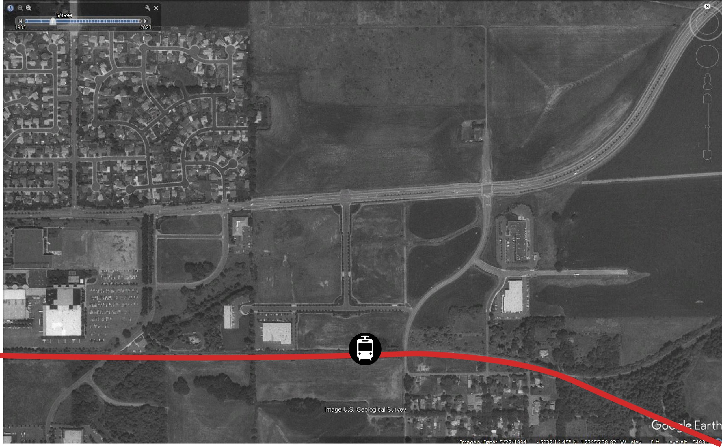
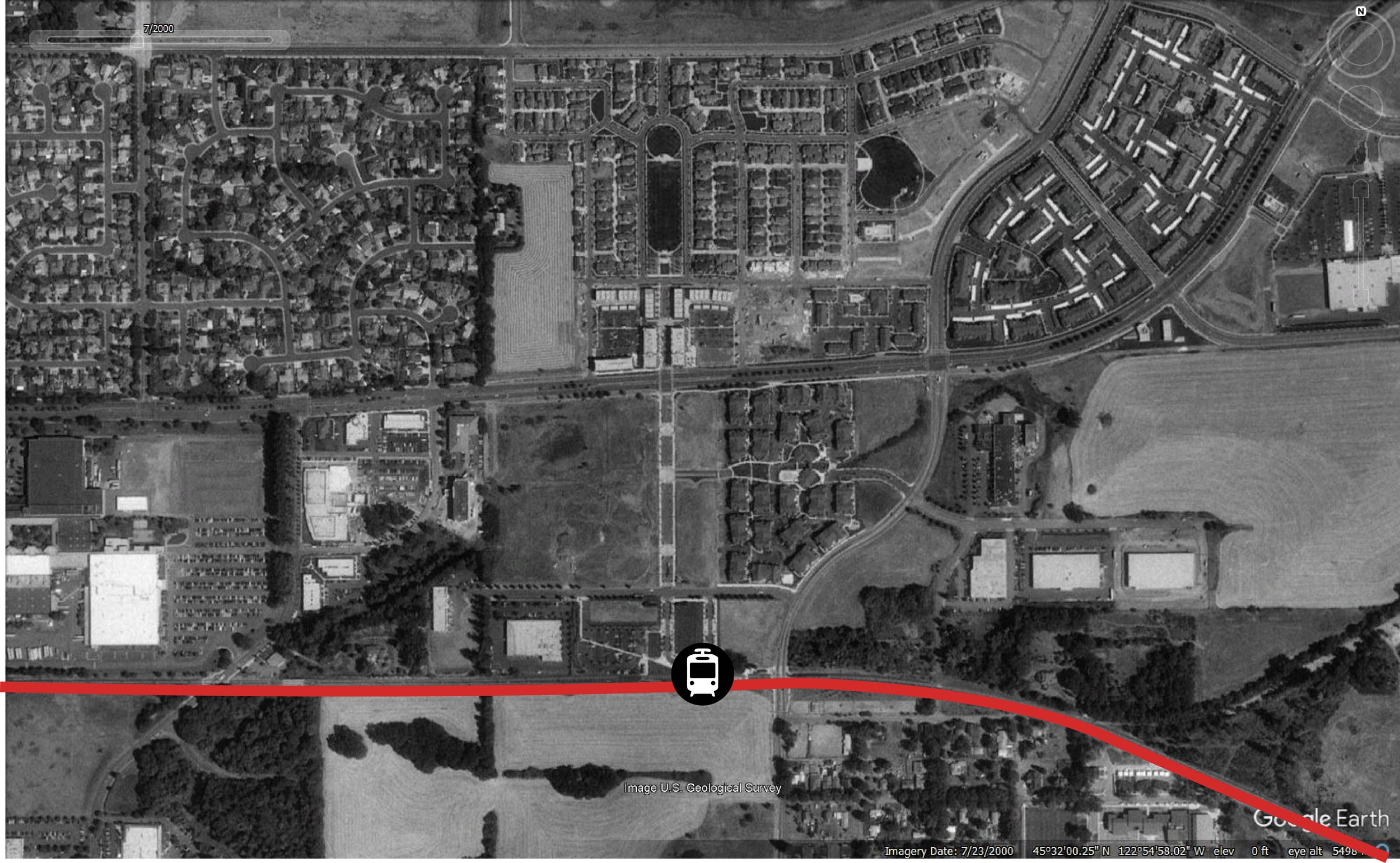
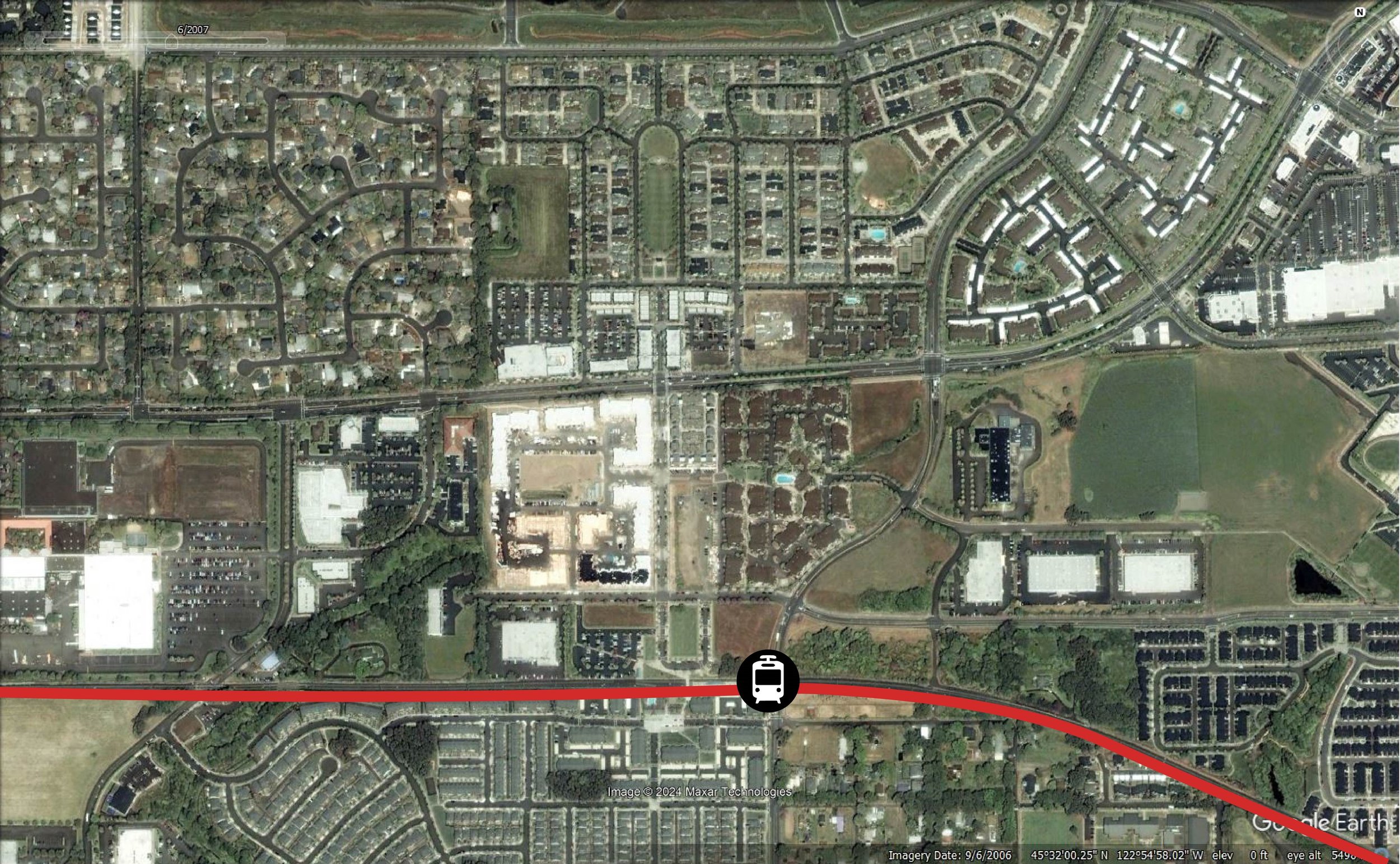
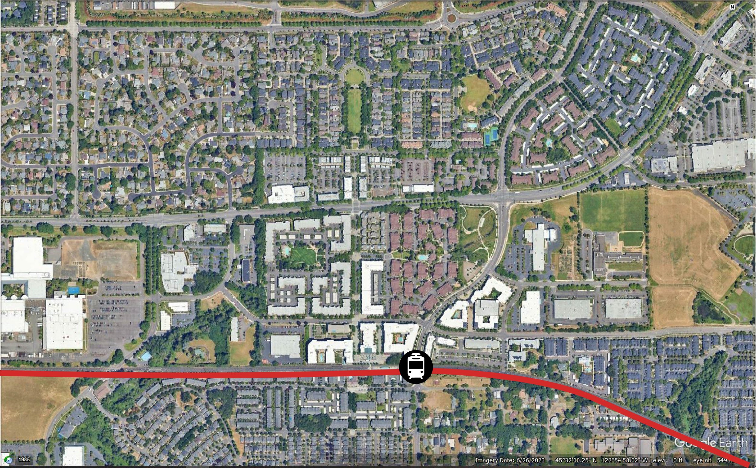
Infill TOD can be successful if a robust design plan addresses land use and scale compatibility with the existing neighborhood.
Successful infill TOD occurs when transit-supportive land uses and densities are constructed on undeveloped or underutilized parcels without adverse impacts on existing stable development. Infill TOD development sites can provide:
Existing public infrastructure, services, and amenities that support and encourage new development.
An existing population that provides immediate transit ridership.
New transit-supportive growth rather than auto-dependent growth focused at the periphery
REPRESENTATIVE PROJECTS
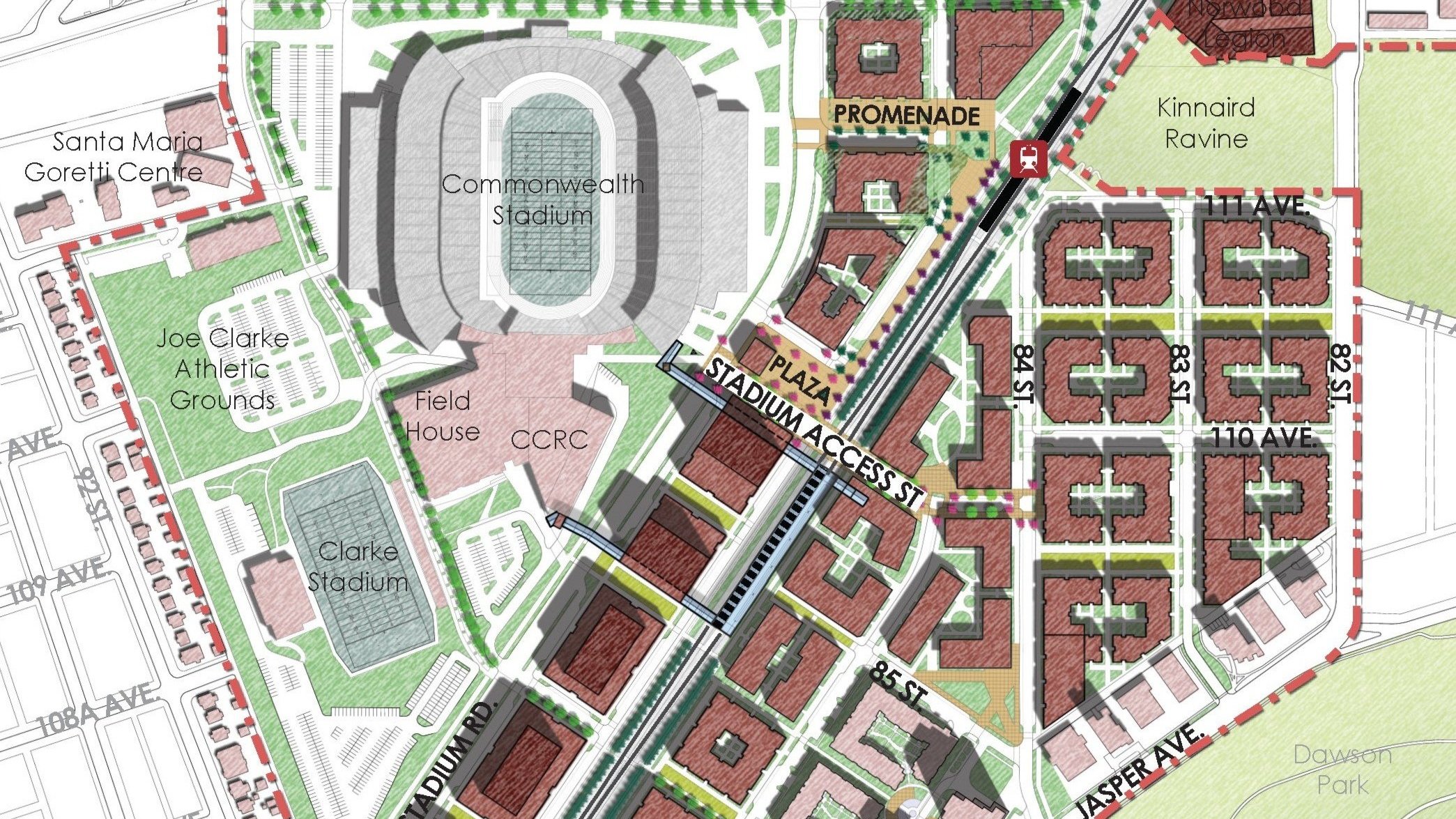
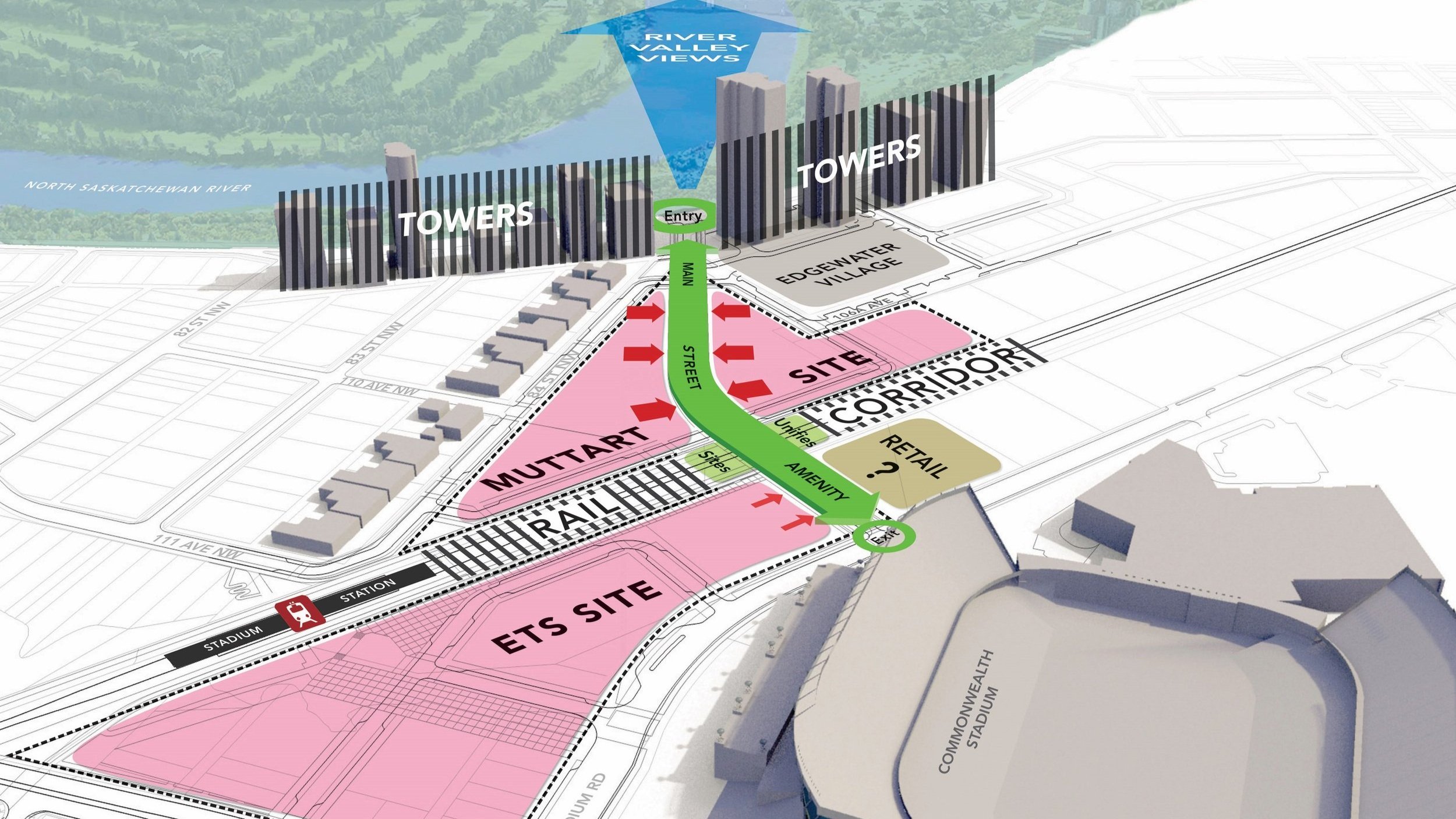
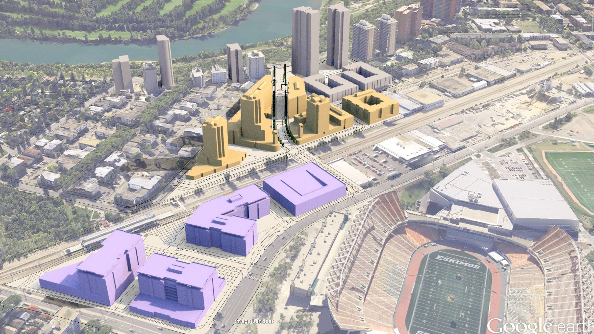
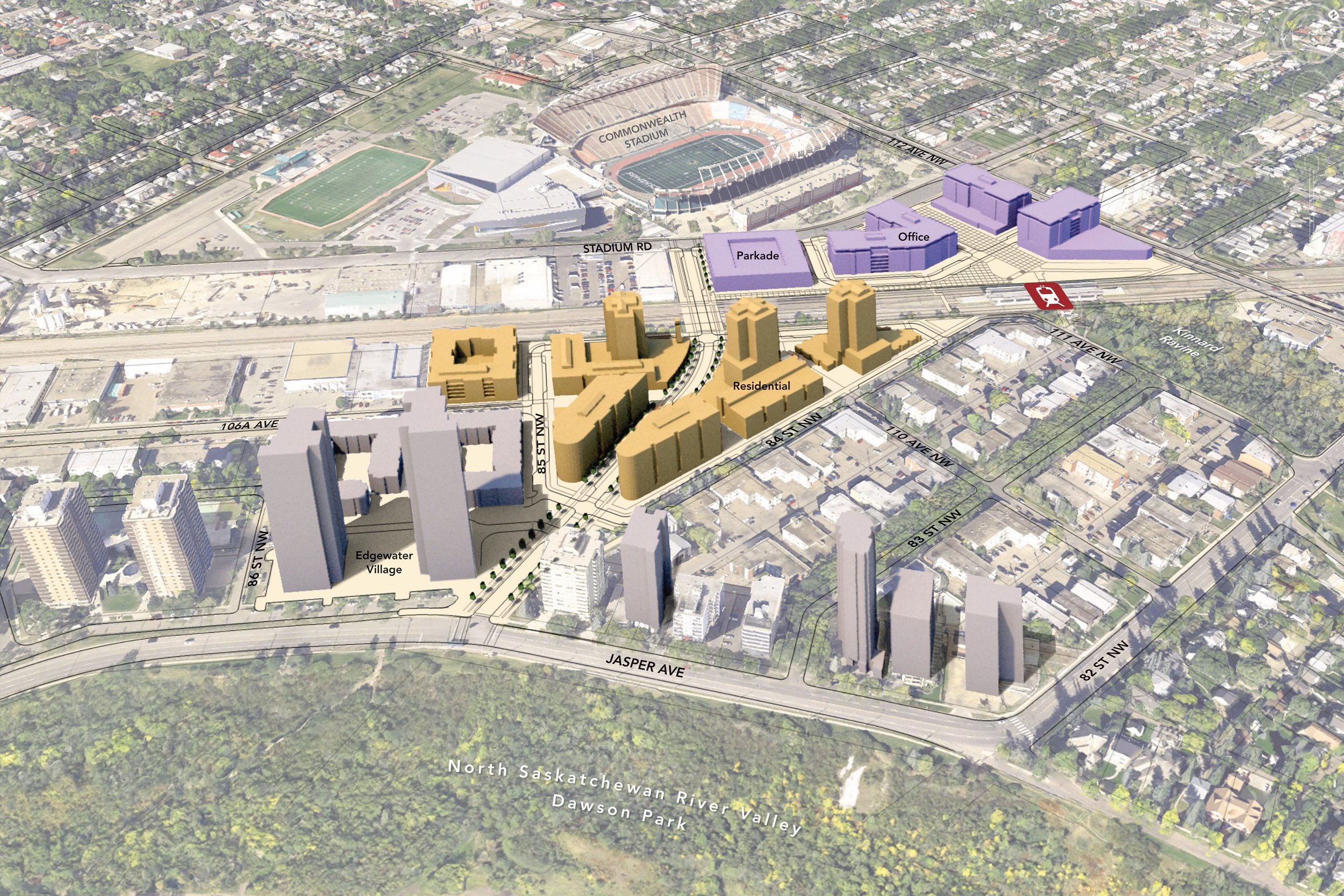
Edmonton, Alberta
Denver, Colorado
Aurora, Colorado
Portland, Oregon
Redmond, Washington
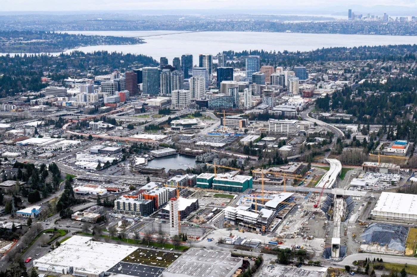
Bellevue, Washington
Oak Park, Illinois
Spokane Valley, Washington
Tukwila, Washington
Saint Paul, Minnesota
Glendale, California
Greenfield TOD
The most essential element for a greenfield TOD is a grid of complete streets.
Greenfield TOD occurs when transit-supportive land uses, densities, and a grid of streets are constructed in a previously undeveloped area. Greenfield sites are typically located on the suburban fringe of a metropolitan region. In some instances, large reuse sites located within urban areas are also considered greenfield sites. Opportunities associated with greenfield TOD development include the potential to:
Effectively implement ideal TOD land uses and street and block configurations around transit stations
Provide medium-and high-density land uses, thus increasing the potential for higher long-term transit ridership
Reduce compatibility concerns between existing conditions and TOD land uses, scale, and character
REPRESENTATIVE PROJECTS
Hillsboro, Oregon
Redmond, Washington
Beaverton, Oregon
Spokane Valley, Washington
Edmonton, Alberta
Oakdale, Minnesota

Orenco Station today - view towards platform
orenco station today - platform
TOD Station Area Plans


Mobility Oriented Districts (MOD)

West Glendale Community mod - glendale, ca
The MOD is a fundamental building block in the development of a resilient district, city, or region.
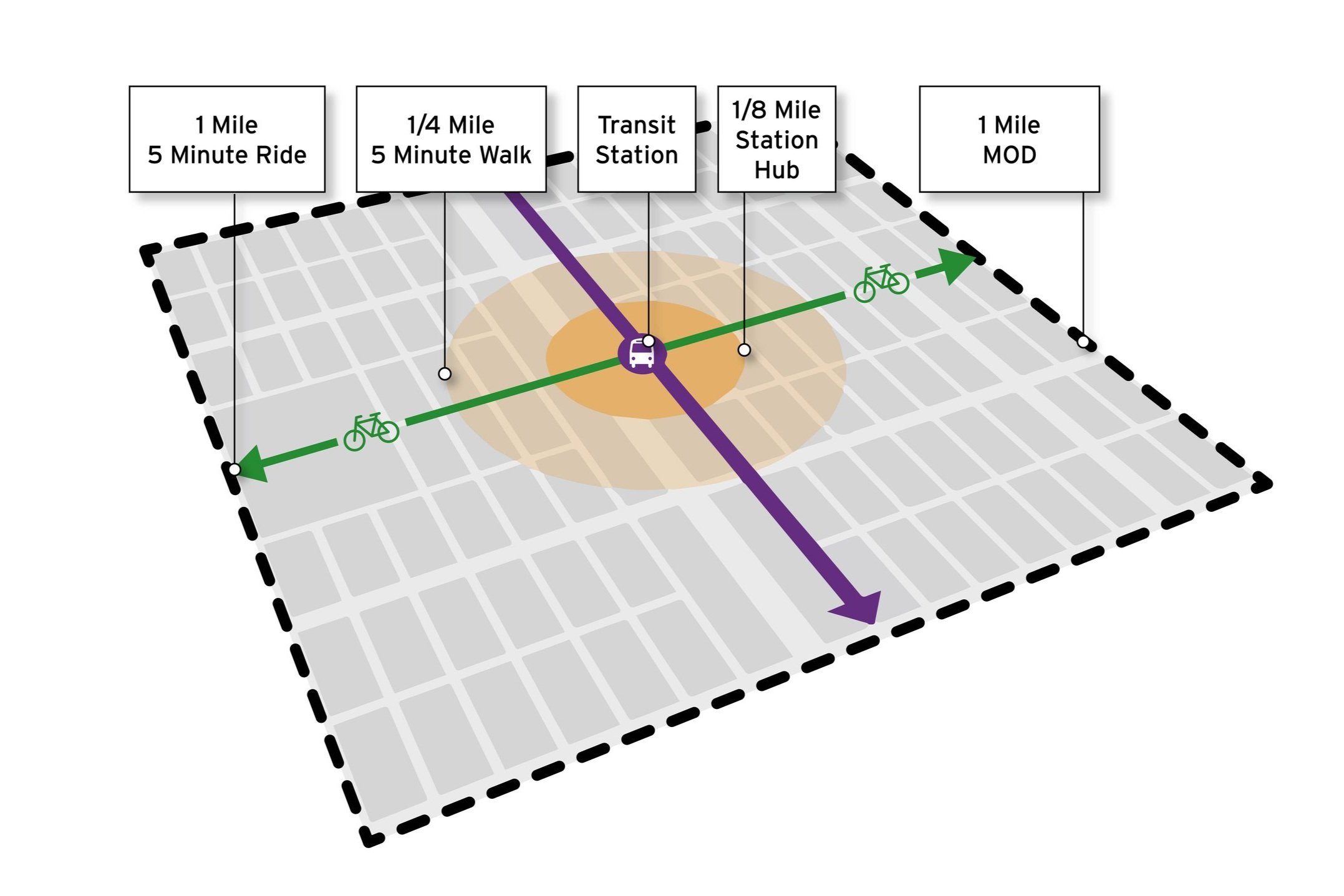
Crandall Arambula has developed a new concept—Mobility-Oriented District (MOD)—that takes station area planning to the next level. MODs incorporate biking into the TOD transportation network of LRT and walkable streets.
MODs increase ridership by capturing additional riders within larger ‘user sheds.’ Our MOD designs consider a one-mile radius surrounding a transit station rather than the typical one-quarter-mile TOD radius. MODs have the potential to increase transit ridership by up to 30% by providing this larger user shed with multi-modal access to the station. This approach is particularly beneficial in suburban areas.
MOD is the next generation of TOD.
By linking a neighborhood’s commercial center to the surrounding one-mile area with complete streets and protected bikeways (cycletracks), this design approach enables people to walk, bike, or take transit for day-to-day shopping and work trips.
Add Protected Bikeways to Create MOD
As a rough rule-of-thumb, people in typical communities rarely travel more than five minutes to reach transit stations and surround station hub land uses. A five-minute walk covers approximately 1/4 mile, the standard service area for a TOD. A five-minute bike ride covers approximately 1 mile, the standard service area of an MOD. By layering a network of protected bikeways on the fundamental TOD configuration, MOD increases the area served by the retail, commercial and employment uses concentrated at the station.
Protected Bikeways are critical to increasing bicycle ridership and reducing vehicle miles traveled. Because protected bikeways physically separate bicyclists from automobile traffic, people of all ages and fitness levels feel safe and comfortable riding bicycles for their commute, shopping, and other daily trips. The mode split potential with protected bikeways can approach 40%. With painted bike lanes on roadways, the mode split tops out at 7% of all trips.
MOD Benefits
Mobility Oriented District (MOD) is a cost-effective and easy-to-implement model that provides planners with an effective approach to mitigate global warming. Many states have adopted laws that require regional and local agencies to develop integrated land use and transportation plans that demonstrate an ability to reach identified GHG emission reduction targets by 2035. Crandall Arambula’s innovative MOD concept will help agencies meet this challenge by integrating comprehensive land use and mobility patterns to create communities with low ecological footprints. MODs have the potential to shorten and reduce auto trips, resulting in a 50% reduction in transportation energy use.
Moreover, in addition to the MOD benefit of reducing vehicle miles traveled, MOD residents will be less motor-vehicle dependent, resulting in more money being spent locally and thereby providing a local economic stimulus of millions of dollars.
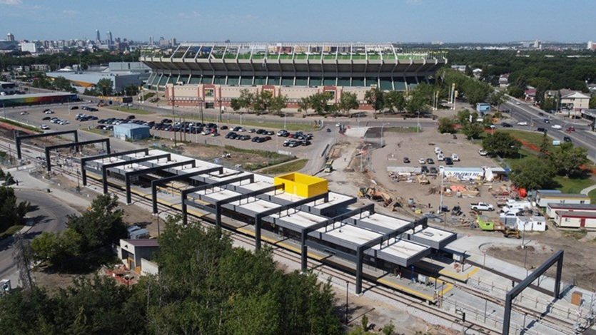
BRTOD Corridors and Station Area Planning
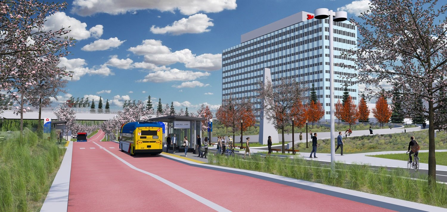
Crandall Arambula has led BRT corridor and station area planning efforts that ensure that individual community visions for each station are integrated to form a cohesive corridor-wide TOD plan.
In cities with a history of high bus ridership, BRT is generally viewed as a premium mode of transit and in turn, the potential BRTOD is higher.
REPRESENTATIVE PROJECTS
Glendale, California. (North Hollywood to Pasadena BRT)
Washinton & Ramsey Counties, Minnesota. (Gold Line BRT)
Ramsey County, Minnesota. (Purple Line BRT)
Springfield, Oregon. (Emerald Line BRT)

Emerald Line BRT - Eugene - Springfeild oregon
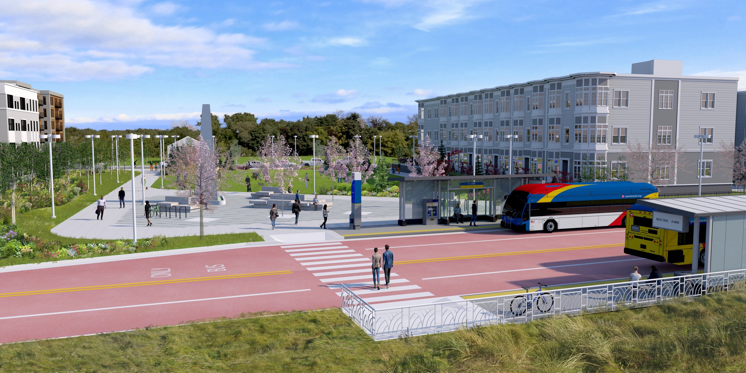
‘True BRT’
BRT systems can offer more TOD potential than city bus systems due to the dedicated or exclusive infrastructure.
Achieving BRTOD requires ‘premium’ bus vehicles that have a similar look and feel to a streetcar or light rail vehicle that travels in a dedicated or exclusive lane providing passengers a more rapid, frequent, and dependable transit service than city buses that share travel lanes with car and truck traffic.
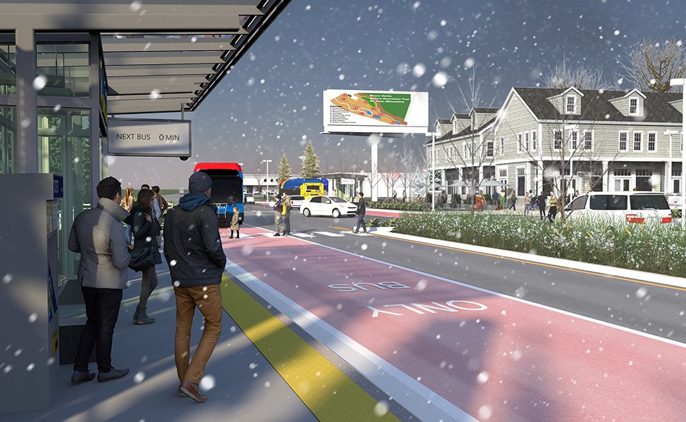
Moreover, BRTOD requires BRT platforms that include ticketing, low-floor boarding, shelters, and other LRT-like infrastructure.

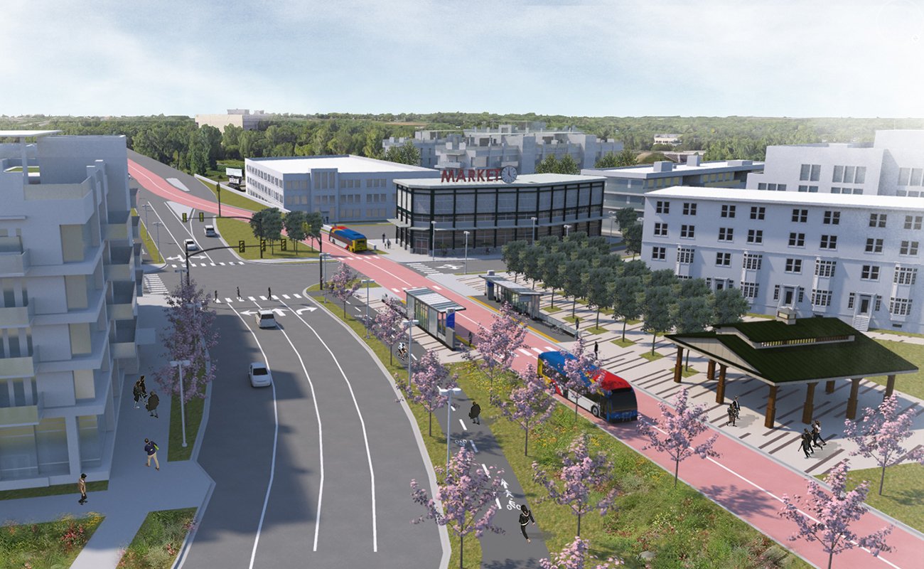
Gold Line helmo station - impact apartment development (Completed 2024)
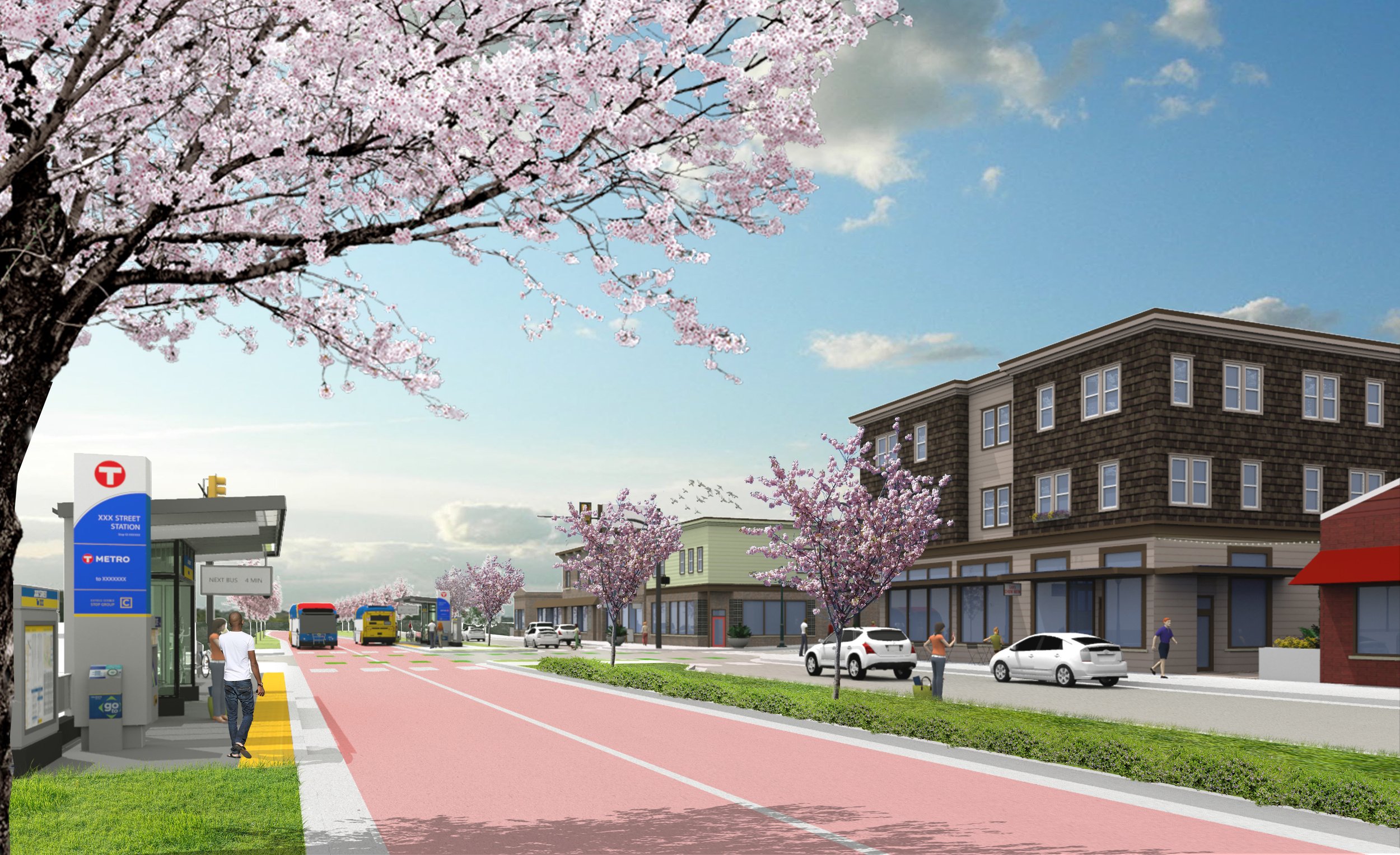
Station Area Development Plans
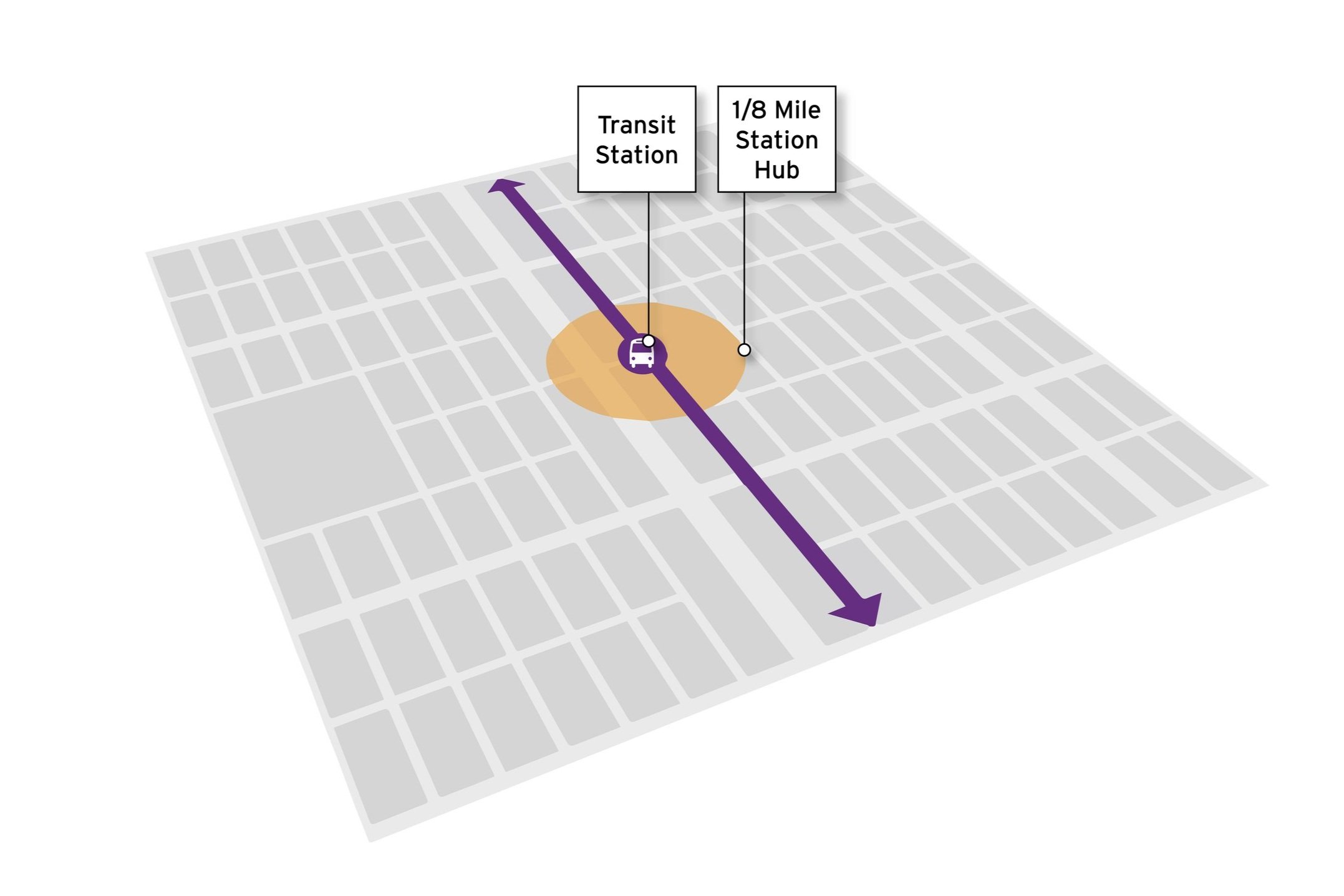
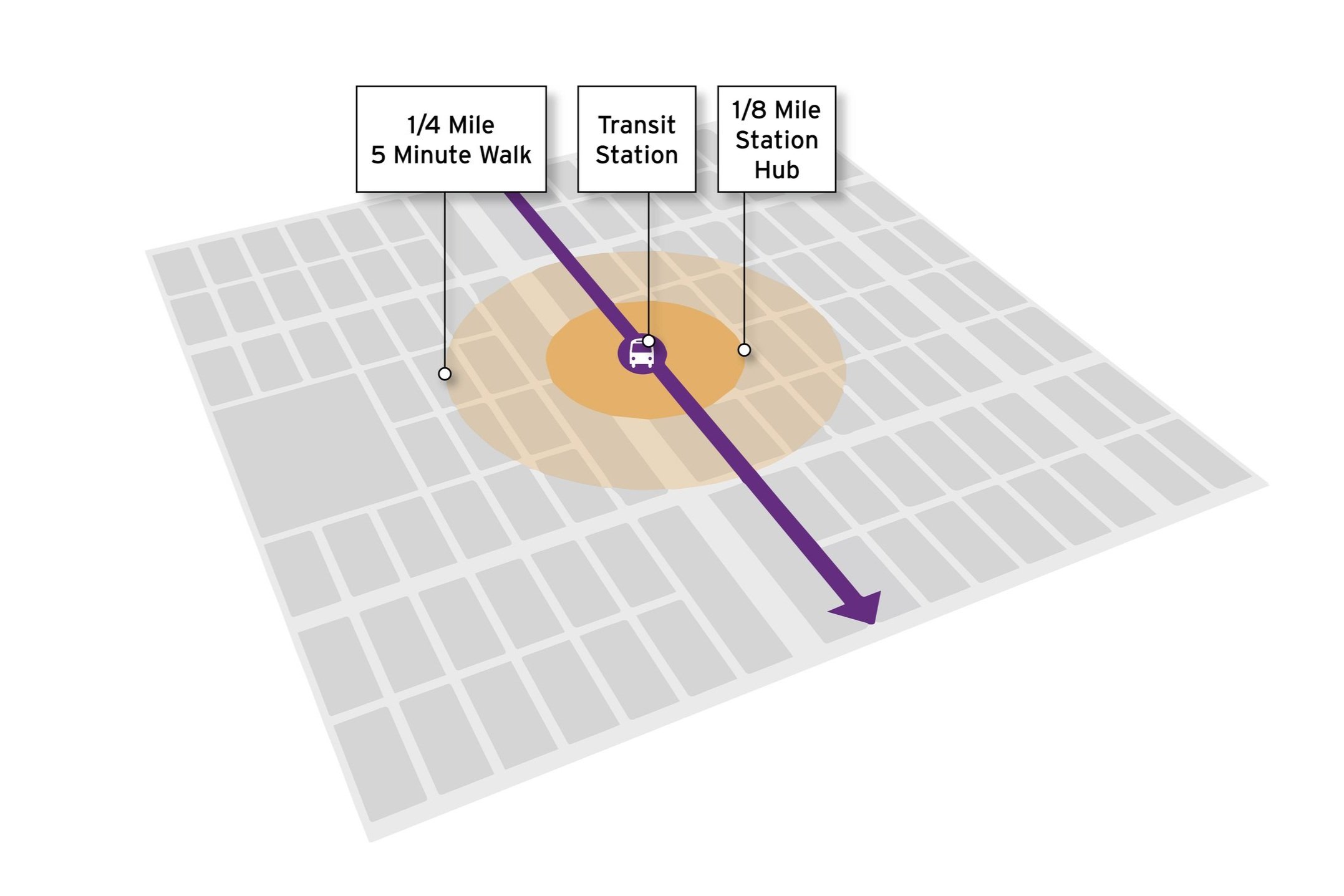
Like conventional TOD, BRTOD focuses on the area within an eighth mile of the station as the home to the highest intensity of trip-generating retail and employment uses and dense residential types, such as multi-family apartments, condos, or townhomes.
Within a BRTOD corridor, the areas within a quarter-mile of the station include the largest concentration of housing and should include a mix of rental and ownership properties to support a mix of income levels.
In developing BRTOD, existing stable and desirable uses should be preserved and strengthened, with new development and redevelopment targeted to vacant and underutilized sites and sites with long-term redevelopment potential. Targeted development builds the concentration and type of land uses appropriate to addressing market demand, meeting gaps in housing, employment, or commercial uses, and supporting an equitable and vital station area.
Gold line station typologies
Station Typologies and Station Access Hierarchies
As an initial step, Crandall Arambula establishes ‘Station Typologies’ for each BRT station based on site conditions, market conditions, and demographics.
These station typologies reflect the complementary roles of the stations along the corridor and inform the type and intensity of transit-oriented development emphasized in each station’s development plan.
Station typologies respond to station-specific community desires and adopted policies and plans while being consistent with best practices for transit-oriented development.

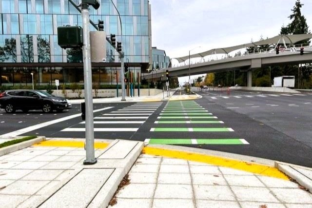
Gold Line Landfall station protected bike lane
‘First and Last’ Mile Trips
Crandall Arambula focuses active transportation planning on ‘first- and last-mile’ trip connections, which are particularly important for communities where jobs and residences are along unsafe routes or are outside of a comfortable walking distance from an existing or planned transit station. When transit users have difficulty making the first- or last-mile connection due to distance, unsafe conditions, or other barriers, transit ridership, and the potential benefits of transit access are not realized.
Crandall Arambula identifies and creates a hierarchy of complementary access route types to address the need for connections between stations and within each station area necessary to achieve BRTOD. This complete and connected network serves walkers, bicyclists, and other users who arrive on wheels.